
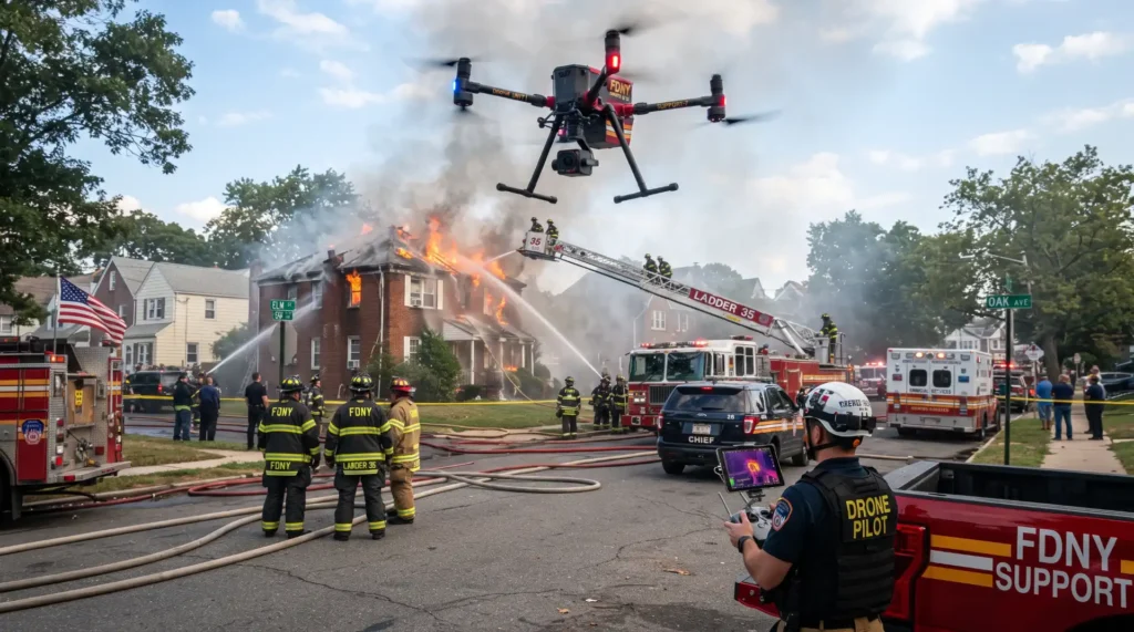
Fire departments across the United States are increasingly adding drones to their emergency response capabilities. These small unmanned aircraft can provide aerial views, thermal imaging, mapping, search support, and real-time information without immediately placing firefighters in hazardous areas. From structure fires and wildfires to search and rescue incidents, drones are becoming another tool that incident commanders can use to understand rapidly changing emergencies.
A fire department drone does not replace firefighters, helicopters, traditional apparatus, or established incident command procedures. Instead, it can provide information that might otherwise be difficult, dangerous, expensive, or time-consuming to obtain.
Modern drones can carry high-resolution cameras, thermal sensors, mapping equipment, spotlights, and other specialized technology. When operated by trained personnel under applicable Federal Aviation Administration rules, these aircraft can give fire departments a different perspective on an incident.
That perspective can matter when every side of a building cannot be seen from the street, smoke limits visibility, terrain prevents ground crews from reaching an area quickly, or a large incident covers many acres.
Why Drones Are Becoming More Common in the Fire Service
Fire departments have always adapted to new technology. Radios transformed communication. Thermal imaging cameras gave crews another way to locate heat through smoke. Computer-aided dispatch improved incident coordination. Geographic information systems made mapping more useful.
Drones represent another stage in that development.
A drone can reach an aerial position within minutes when a trained team and aircraft are available. Unlike a helicopter, a small drone does not require a flight crew, airport, or large operating area. This accessibility has made unmanned aircraft particularly interesting to municipal fire departments, county agencies, wildland firefighting organizations, and regional public safety teams.
The Federal Aviation Administration recognizes public safety drone operations and provides specific information for government agencies developing unmanned aircraft programs. Public safety agencies generally operate qualifying drones under Part 107 or applicable public aircraft provisions. Departments also need to account for airspace restrictions, operational requirements, pilot qualifications, and other federal rules.
For departments already focused on community service and public education, technology can complement the traditional mission of firefighters. Pink Fire Truck has previously explored the broader role of fire trucks and firefighters as symbols of emergency response, outreach, and public service through its coverage of the story behind the Pink Fire Truck.
Today, emergency response can involve far more technology than the equipment visible on a fire engine.
Seeing a Fire From Above
One of the clearest advantages of drones is aerial visibility.
When firefighters arrive at a large structure fire, their initial view is usually limited by surrounding buildings, trees, walls, smoke, terrain, and other obstacles. An incident commander standing on the ground may not immediately see what is happening on the back side of a structure or across a large roof.
A drone can provide an elevated view.
From above, operators may identify smoke movement, roof conditions, fire extension, access points, nearby exposures, and the general footprint of an incident. Live video can also help command personnel compare conditions in different areas without physically moving from one side of the scene to another.
This information does not determine tactics on its own. Firefighters still need to evaluate structural stability, fire behavior, building construction, available resources, life hazards, and many other factors.
However, an aerial view can add another source of information to that decision-making process.
During large commercial fires, warehouse incidents, industrial emergencies, or incidents involving multiple buildings, the benefit can become especially noticeable. A drone can observe a larger area than an individual firefighter positioned at street level.
 Thermal Imaging From the Air
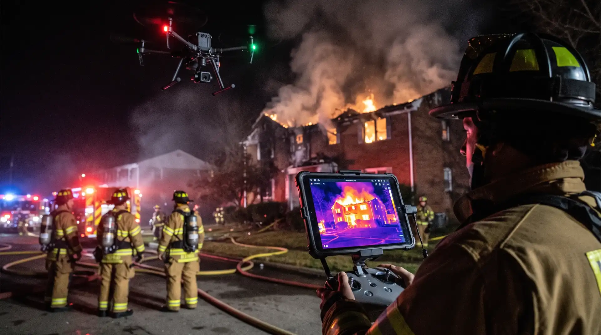
Thermal imaging is one of the most useful technologies available on many public safety drones.
Traditional handheld thermal imaging cameras have been used by firefighters for years. Drone-mounted thermal cameras apply a similar concept from an aerial perspective.
Instead of relying only on visible light, thermal sensors detect differences in heat.
During a structure fire, this capability can help crews identify unusually hot areas of a roof or exterior. After visible flames have diminished, thermal imagery may also help locate areas that remain significantly hotter than surrounding materials.
This aerial information can assist firefighters during size-up, suppression, and overhaul activities.
Thermal imaging can also be useful outside structural firefighting. Search teams may use heat signatures to help locate people in open areas under suitable conditions. Wildland firefighters can use thermal cameras to identify hotspots. Emergency personnel may use them when evaluating areas that are difficult to inspect directly.
Thermal imagery still requires careful interpretation. Sun-heated roofs, equipment, reflective materials, environmental conditions, insulation, and other factors can affect what operators see.
For that reason, drone imagery works best as another information source rather than a substitute for physical investigation.
Supporting Search and Rescue Operations
Not every fire department call involves fire.
Departments throughout the United States routinely respond to missing-person incidents, vehicle crashes, water emergencies, wilderness rescues, natural disasters, medical emergencies, and other situations requiring rapid location of people.
Drones can support some of these searches.
Consider a missing hiker in a large wooded area. Ground crews may need to cover miles of difficult terrain. Depending on vegetation, weather, airspace, and visibility, a drone can survey selected areas from above and provide information to search teams.
Thermal cameras may assist under appropriate conditions by identifying heat signatures that stand apart from their surroundings.
Drones may also examine cliffs, steep slopes, drainage channels, open fields, disaster zones, or other locations that are challenging for ground personnel to inspect quickly.
Aerial reconnaissance can help search coordinators decide where crews might focus their attention, but it does not eliminate traditional search methods. Thick tree cover, heavy vegetation, buildings, weather, temperature conditions, battery limits, and terrain can all restrict drone effectiveness.
Human search teams, dogs, helicopters, boats, and specialized rescue personnel may still be necessary depending on the emergency.
The value of a drone comes from expanding the tools available to responders.
Improving Wildfire Situational Awareness
Wildfires present some of the strongest use cases for unmanned aircraft.
A rapidly changing wildfire can extend across mountains, forests, grasslands, residential communities, and transportation corridors. Smoke can make visibility difficult. Fire behavior can change with wind, terrain, fuels, and weather.
The FAA states that unmanned aircraft are being used in wildfire response for real-time situational awareness, hotspot detection, perimeter mapping, infrastructure assessment, and other tactical support. Federal agencies also coordinate drone operations with manned firefighting aircraft because safe airspace management remains essential.
A drone equipped with thermal technology can help identify areas where heat remains after flames appear to have passed. Mapping systems can help teams visualize portions of a fire perimeter. Repeated flights may provide information showing how conditions have changed.
Drones can also inspect areas where sending personnel immediately might expose them to unnecessary hazards.
That capability becomes particularly valuable during operations involving steep terrain, unstable burned areas, downed power lines, damaged infrastructure, or other hazards.
However, wildfire airspace can be extremely complex.
Air tankers, helicopters, lead planes, reconnaissance aircraft, and other aviation resources may operate around an incident. Unauthorized drones can create serious danger and may interfere with firefighting aircraft.
The FAA has repeatedly emphasized that drone operators must follow airspace restrictions around emergency operations. In 2026, the agency also highlighted enforcement against unsafe and unauthorized drone operations that endangered emergency response activities.
For the public, the lesson is straightforward. A personal drone should never be flown near an active wildfire or emergency scene simply to capture photographs or video.
Mapping Large Emergency Scenes
Some emergencies are simply too large to understand from ground level.
Floods, tornadoes, hurricanes, wildfires, explosions, train incidents, industrial accidents, and major storms can affect broad areas.
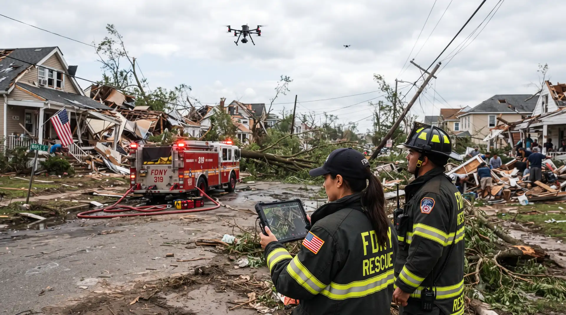
Drones equipped with mapping software can capture overlapping photographs and turn them into detailed aerial maps. These maps may help emergency teams understand road access, damaged buildings, debris fields, flood boundaries, infrastructure problems, and other conditions.
After a severe storm, for example, a department might need to know which roads remain usable before sending heavy apparatus into affected neighborhoods.
Following a large fire, aerial images may help show the extent of damage.
During a flood, a drone may reveal where water has crossed roads or isolated structures.
Emergency managers can combine this information with traditional maps, dispatch reports, ground observations, and information from other agencies.
The result can be a clearer picture of an incident.
Assessing Dangerous Structures
Fire-damaged buildings can create hazards long after flames are reduced.
Roofs may sag. Walls may become unstable. Chimneys can crack. Exterior materials can loosen. Portions of a structure may become difficult to inspect safely.
A drone provides one way to observe some of these areas without immediately placing a firefighter next to or on top of the hazard.
High-resolution cameras can capture roof conditions, upper floors, exterior walls, towers, industrial structures, and other elevated areas.
This does not replace an engineer, building official, fire investigator, or physical inspection when one is necessary.
It can, however, provide preliminary information.
The same principle can apply after tornadoes, hurricanes, explosions, earthquakes, or other destructive events. Crews can inspect selected areas from a distance before deciding what resources need to enter.
Reducing unnecessary exposure is one reason drone technology has attracted so much attention across public safety.
Helping Incident Command See the Bigger Picture
Emergency scenes produce enormous amounts of information.
Radio traffic, crew assignments, building conditions, weather, water supply, medical needs, traffic, evacuation concerns, and changing hazards may all compete for an incident commander’s attention.
Drone video can add a visual layer to this operational picture.
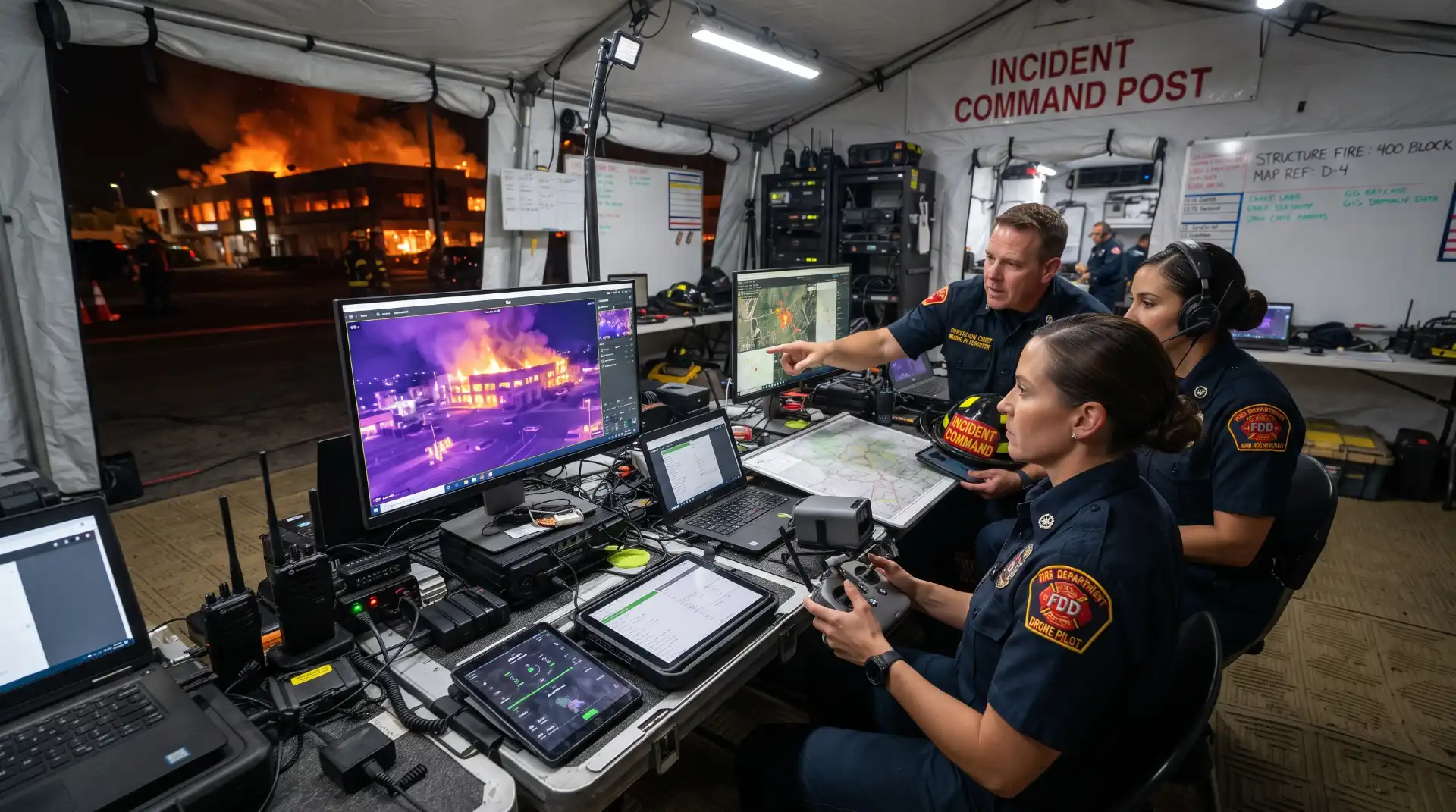
Instead of receiving only verbal reports about conditions in a remote part of the scene, command personnel may be able to observe aerial imagery directly.
For example, a drone might show that fire has spread to a neighboring building, that smoke has increased from a particular roof section, or that an access road has become blocked.
During a brush fire, the aerial view could reveal flames approaching structures that are difficult to see from a command post.
The greatest value is not simply having video. It comes from delivering useful information to the people who need it without overwhelming them.
Departments developing drone programs therefore need procedures for deciding who watches the feed, who communicates findings, how information reaches command, and how drone operators fit into the incident command system.
Technology needs organization to become operationally useful.
Supporting Fire Investigations
Drones can also play a role after emergency suppression activities have ended.
Fire investigators often document structures, burn patterns, surrounding property, and other physical conditions. Aerial photography can provide a perspective that ground photographs cannot.
For large fire scenes, drone imagery may show the relationship among multiple structures, surrounding vegetation, access roads, utility infrastructure, and damaged areas.
Photogrammetry software may also help create detailed visual models.
These tools do not determine the origin or cause of a fire automatically. Fire investigation requires trained professionals who evaluate physical evidence, witness information, fire behavior, scene conditions, and other relevant factors.
Drone imagery simply adds another form of documentation.
Emergency Communications and Public Information
Drone images can have value beyond tactics.
During large emergencies, public agencies need to explain hazards clearly. Residents may need evacuation information, road closure details, wildfire updates, or instructions about areas that remain unsafe.
Properly approved aerial images may help agencies communicate the scale of an incident.
This is another area where public safety intersects with community awareness.
Pink Fire Truck has long emphasized the connection between first responders and community engagement, including through its discussion of raising awareness and strengthening community connections.
Modern fire departments increasingly communicate through websites, emergency notification platforms, social media, public meetings, and community outreach programs.
Drone imagery can contribute to that communication when agencies follow privacy, operational, and evidence-handling policies.
What Equipment Do Fire Department Drones Carry?
A public safety drone may look similar to a consumer aircraft, but many fire-service systems contain specialized features.
High-resolution zoom cameras allow operators to inspect structures or terrain from safer distances. Thermal imaging cameras display heat differences. Spotlights may assist during nighttime operations. Some systems include loudspeakers that can broadcast instructions.
Mapping software can convert aerial photographs into detailed models.
Certain platforms are designed for longer flight times, heavier payloads, stronger wind resistance, or challenging weather.
Departments may also use multiple drones for different missions instead of expecting one aircraft to handle every type of incident.
The technology continues to evolve, but purchasing an aircraft is only one part of creating a useful program.
Training, maintenance, data management, batteries, software, pilot certification, operating procedures, insurance, cybersecurity, airspace coordination, and agency policies all matter.
FAA Rules Still Apply During Emergency Operations
Emergency response does not mean unrestricted airspace.
The FAA regulates the National Airspace System, and public safety departments need an appropriate legal framework for drone operations.
Government and public safety agencies can generally operate eligible small drones under 14 CFR Part 107 or under public aircraft requirements using appropriate authorization. The FAA also provides mechanisms that may support emergency operations and expedited authorizations in qualifying circumstances.
Under Part 107, numerous requirements govern small UAS operations. Rules address issues such as aircraft weight, visual line of sight, operating altitude, operations around people, controlled airspace, pilot responsibilities, and safe conduct.
Departments therefore need trained operators who understand both emergency response and aviation rules.
Coordination becomes particularly important when helicopters or airplanes are part of the same incident.
Privacy and Community Trust Matter
A camera capable of observing an emergency scene from the air also creates reasonable questions about privacy.
Residents may want to know when their fire department uses drones, what cameras collect, how long information is stored, who can access recordings, and whether footage may be shared with other agencies.
Clear policies can help departments address these concerns.
Public agencies can explain the purposes of their drone programs, establish data retention practices, define acceptable missions, train personnel, and communicate with residents before concerns arise.
Transparency is particularly valuable because fire departments often have strong relationships with the communities they serve.
Drones work best when residents understand why the technology exists and what safeguards apply to its use.
Community outreach has long been part of the broader fire-service mission. The Pink Fire Truck’s history demonstrates the unique ability of firefighters and fire apparatus to connect public service with community engagement. Readers interested in that relationship can also explore the evolution of the Pink Fire Truck and its community role.
Drones Cannot Replace Firefighters
The rapid growth of drone technology sometimes produces exaggerated expectations.
A drone cannot stretch a hose line, perform CPR, force entry into a burning building, stabilize a vehicle, carry a patient, operate a ladder truck, or replace a trained search team.
It cannot independently understand every condition present at a complicated emergency.
Even sophisticated cameras have limitations.
Smoke, weather, darkness, obstacles, interference, battery capacity, extreme temperatures, restricted airspace, and poor connectivity may affect operations.
A drone is best understood as an information and reconnaissance platform.
Its value comes from helping firefighters gather information while maintaining human judgment at the center of emergency operations.
The Future of Drones in American Fire Departments
Drone technology is developing quickly.
Future systems may offer longer flight times, stronger thermal sensors, improved mapping, better obstacle avoidance, automated flight planning, enhanced communications, and tighter integration with emergency management software.
Artificial intelligence may also assist with analyzing aerial information.
For example, software could potentially help highlight unusual heat signatures, compare changes between mapping flights, identify damaged infrastructure, or organize large collections of incident imagery.
Automation still requires human oversight.
Fire departments operate in complex environments where decisions affect firefighters, patients, residents, property owners, pilots, and other emergency personnel.
Technology can provide more information, but judgment remains a human responsibility.
Another developing area involves remotely deployed or docked drones. In some public safety systems, an aircraft can remain at a fixed station and launch when requested.
The operational and regulatory framework surrounding these programs continues to develop, particularly when flights extend beyond the pilot’s direct visual line of sight.
Departments considering advanced operations need to follow current FAA requirements rather than assuming that new technology automatically permits new flight practices.
The FAA’s public safety drone resources provide current federal information for agencies operating or developing UAS programs.
A New View of Emergency Response
The fire service has always combined people, training, equipment, and information.
Drones add a new perspective to that combination.
An aircraft positioned a few hundred feet above an emergency can sometimes reveal information that crews on the ground cannot easily see. Thermal cameras can identify heat patterns. Mapping tools can document large areas. Aerial video can help command teams watch changing conditions. Search crews can examine difficult terrain without immediately exposing additional personnel to hazards.
During wildfires, drones can assist with hotspot detection, perimeter mapping, situational awareness, and infrastructure assessment. During structure fires, they can provide aerial views and thermal information. After disasters, they can help document damaged neighborhoods, roads, and buildings.
Their usefulness depends on much more than the aircraft itself.
Training, aviation compliance, operational policies, privacy protections, coordination with other responders, reliable equipment, and disciplined use all shape whether a drone program actually improves emergency response.
For U.S. fire departments, drones represent another example of technology expanding what firefighters can see and understand.
The fire engine remains one of the most recognizable symbols of public safety. Firefighters remain at the center of the response. The drone simply provides them with another set of eyes above the scene.
As the technology develops, its most meaningful role may remain straightforward: helping emergency personnel gather better information while reducing unnecessary exposure to hazardous conditions.
That combination makes drones an increasingly significant part of the changing landscape of American emergency response.
Authoritative External Resource
Fire departments, public safety professionals, and readers interested in U.S. drone requirements can review the Federal Aviation Administration’s Unmanned Aircraft Systems resources. The FAA provides information about Part 107, public safety operations, airspace authorization, wildfire response, Remote ID, emergency operations, and other drone regulations.